


The site of Les Boulies at Boécourt (JU) is located at the north-western extremity of the Delémont valley, at the foot of the Les Rangiers pass.
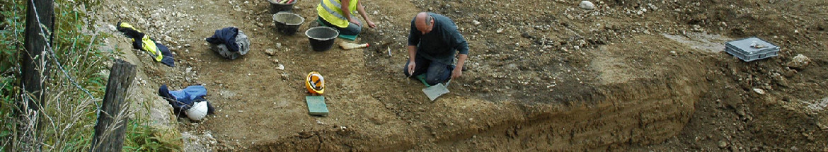
The archaeological research (mining cartography, topographic mapping, sounding and digging) was performed in 1989, during the construction of the N16 Transjurane highway. The fieldwork has provided abundant material for subsequent archaeological research (fragment reassembly, stratigraphy, architecture and quantitative studies) and laboratory analysis (14C and archaeomagnetic dating, palynology, anthracology and metallurgy).
The investigated region is rich in siderolithic iron ore. The ore is composed of iron oxide concretions with centimetre diameters (pisolith) in a red clay matrix (bolus). Previously deposited on the karstic surface of calcareous rocks (Malm) and overlain by Pliocene gravels, erosion has exposed the ore along the slopes of the main ravines.
Ore mining originated with small open pits near the original outcrops, then followed the rich lenses, using trenches and short drifts. During the 19th century deep shafts were utilised to reach the ore at deeper levels. Those works are described by A. Quiquerez (claim of Rayon de Séprais). Some shafts an other mining structures studied on the field can be related to this last phase of activity.
The older works are clearly evident due to changes in the topography, but, at present no chronological data exists for this earlier period.
In the small valley of Les Boulies, remains related to artisanal iron working have been found. The workshop where the iron ore was reduced is composed of two furnaces, several roasting hearths and rejected slag piles: these remains yield a merovingian age. At a distance of some metres away is a washed or deposit. In the lower part of the valley, a paleostream was used to wash the ore. Other structures (holes, channels, etc), which are more difficult to interpret, are also probably related to the preliminary treatment of the ore. During the Early Middle Ages, surface extraction possibly took place at the entrance of the lesser valley, where Siderolithic outcrops occurred. But, in this area, subsequent human activity has obliterated the older traces.
Situated on the side of the slope, the two furnaces devoted to the reduction of iron ore were built and repaired many times. Stratigraphy and architecture demonstrate that furnace 1 predates furnace 2. However, during the main phase of activity, the two furnaces were in simultaneous or alternate operation. After the destruction of furnace 1, the second one was used alone.
These two furnaces show only minor differences and both are very similar to the early medieval structures found in Jura vaudois (Bellaires) and in Lorraine (Ludres).
The bottom of the furnaces is lightly fastened to the substratum. The walls of the shaft are composed of a mantle of stone with an internal lining of sand, strengthened with roman tiles fragments. The front part with the large door was not well preserved. The height oh these structures reached 1,50 m. A small shallow basin is situated in front of the furnace. The air was supplied by a double set of bellows. A first tuyere is located more or less horizontally through the wall of the shaft, 50 cm above the bottom. A second frontal tuyere sloping downwards was placed in one half of the door. The second half was open to allow the liquid slag to flow out. The metallic iron, in a pasty condition, was extracted at the end of the operation.
The slags from the last reduction process of furnace 2 have been found in situ. This last tapping comprises about sixty distinct pieces. Tapping slag occurs in proportion of the progress of the work. The aspect of the surface changes with the viscosity of the liquid and the flow slope. In some cases, the flow is vertical, demonstrating the existence of a door-sill. Reassembly of the smaller fragments into complete pieces demonstrates different morphologies within the same object.
During the last operation in furnace 2,40 kg of slag's were produced. A total amount of 5500 kg is estimated for the all site. Calculations from the chemical analysis of ores. fragments of walling and slag's suggest approximately 7 kg of iron (bloom) was produced during one operation, and that total the production from the workshop was approximately 1 ton.
Some slags with a plano-convex shape were reused as building material for furnace 2. These pieces can be distinguished from the reduction slag by morphology and chemical composition, and are the results of refining the raw iron bloom, within a hearth. Currently no structure exists on the site that can be related to this type of work. Therefore the presence of a professional workshop within the vicinity can be presumed.
The workmen used charcoal from beech and fir trees as fuel. These trees are presently abundant within the forests of the Jura Mountains above 600 meters. After the abandonment of the site, the forest was less abundant since the spectra of pollens indicate that species of trees preferring light and humidity (birch and hazel) dominate. Agriculture was practised in the open spaces of the forest. Although the workshop has had an influence on the landscape, it cannot be solely responsible for the changes.
The workshop at Les Boulies was a small enterprise with locally abundant raw materials (ore and charcoal), and the production did not exceed the local needs. Nevertheless, it should be noted that this site is within the iron working district of Jura which is the most important in Switzerland.
The merovingian iron industry has left traces in other regions of Switzerland (Vaud and Schaffhouse). At this time, the Delémont valley also has had a large population as evidenced by the numerous cemeteries within this region.
Translation: Robert Fellner

CAJ 3 - Abstract
 Imprimer


Copyright © jura.ch - 2024