


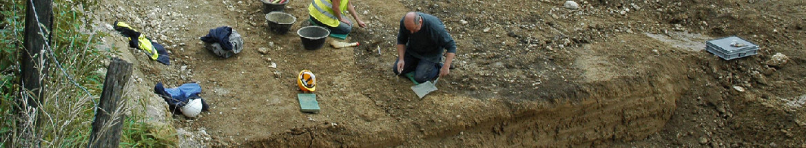
The gallo-roman settlement of les Montoyes, close to the village of Boécourt, Canton Jura, was first reported by Auguste Quiquerez during the middle of the 19th century, and has recently been rediscovered as a result of surveying and test-trenching along the lie of the A16 motorway. Situated at the western extremity of the valley of Delémont, at the foot of the Rangier pass, the farm stood on the southern face of a small hill, dominating a pond that once flowed a few meters below it. During three field seasons (1988, 1989, and 1990), a surface covering more than 5000m2 was exposed.
While the site has suffered considerably from erosion, it has nonetheless been possible to distinguish two principal occupation periods, and through their development the roman cultural penetration of the countryside could be made manifest.
The first occupation dates from the middle of the first century A.D. It is a "native farm", i.e. a modest group of buildings surrounded by a system of ditches. While this is the first published settlement of this type in Switzerland, such farms have been found frequently in belgian Gaul, particularly in Picardy (Agache 1976). Such structures are clearly derived from pre-Roman models. At les Montoyes, the occupied area was limited by a series of ditches (more than 500m of ditch have been uncovered) enclosing an area of roughly ten acres. They form a large yet incomplete quadrangular enclosure with two interior limits and several branches. This system is quite complex and seems much more developed than might initially be believed. Two small stone structures, separated by roughly 50m, were found in the eastern part of the enclosure, while a hut, a cattle pen, and possibly a granary, all earth and wood constructions, were strewn over its western half.
Towards the end of the 1st century A.D. the settlement was transformed by a series of changes from the "native farm" of celtic tradition to a rural villa of the roman type. The transformation remained incomplete, and the use of older elements in the new architectural programme signals a remarkable continuity of occupation. The western part of the ditch enclosure was replaced by a stone wall, the northern stone structure was rebuilt on a basilical plan, new rooms -one with a hypocaust heating system- were added to the southern stone structure, and the shore of the pond was consolidated by a stone setting attached to the encircling wall. The eastern part of the ditch enclosure remained, however, unchanged. Altogether we thus have the impression of a mixed settlement, formed to the east by two stone buildings and an encircling wall ("pars urbana") and to the west by earth and wood structures and a series of ditches -remains of the initial establishment that continued to be used unchanged ("pars agraria"). In the latter, a large number of pits - remains of silos, refuse dumps and hearths - demonstrate the use of this area during the entire occupation.
The abandonment of the site is clearly linked with the happenings of the middle 3rd century A. D. The absence of any sign of violent destruction would seem to indicate, however, that the inhabitants had fled before the arrival of the germanic invaders. No trace -except for a coin hoard found in the area in 1913, witch was dated to after 353 A.D. -of a fourth century occupation could be discovered. The artefacts, mostly potsherds, have a strong native, i.e. celtic component. Together with the architecture, the building materials and techniques, this is another indicator of the rural and conservative nature of this settlement.
Parallel to the archaeological investigations, several specialist analyses were undertaken on the site, namely of a dendrochronological, geological, palynological and osteological nature. On the basis of a pluridisciplinary synthesis, a reconstruction of the environment surrounding the settlement has been made possible (Chapter 12.7). A mixed beech and fir forest covered much of the surrounding countryside, including the hills on the valley floor. The farm was situated in a large clearing, above the pond, whose shores were covered by a reed bed. An alder grove probably encircled much of the pond. The western part of the clearing was covered with fields, while the pastures were in its eastern half. The front cover and illustration 96 represent an artists' view of this environment.
This type of settlement has only rarely been the subject of an exhaustive excavation. Its character, so different from the medium and large villas well known in Switzerland (e.g. Viques, Canton Jura; Seeb, Canton Zürich; Orbe, Canton Vaud) , helps us to complete our knowledge of the roman countryside.
Translation: Robert Fellner

CAJ 1 - Abstract
 Imprimer


Copyright © jura.ch - 2024